
Does a viral photo show the damage from an airstrike against an early warning radar system in Qatar? No, that's not true: This picture is fake and does not show the radar system in question. There are many differences between the fake image and the real facility visible on satellite images.
The fake image appeared in a post (archived here) published by @iranin_arabic on March 3, 2026. The automatic Grok translation of the caption from Arabic to English reads:
Unfortunately, this is just the beginning.
This is the image included with the post:
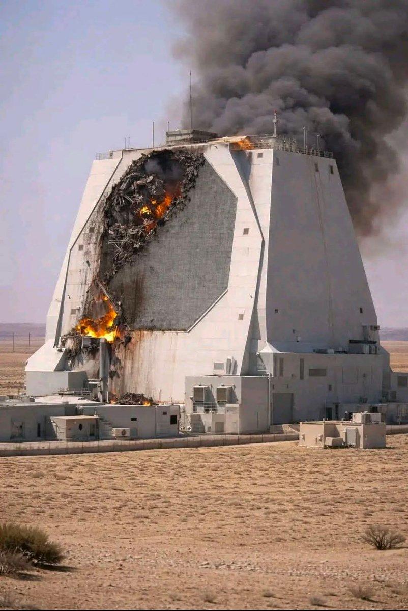
(Image source: post from @iranin_arabic on X.)
A post with no images (archived here) on X by the Tehran Times on Feb. 28, 2026 relayed an announcement from the Islamic Revolutionary Guard Corps (IRGC):
#BREAKING IRGC Public Relations: The American radar FP132, with a range of 5,000 kilometers, stationed in Qatar with unique equipment designed for tracking ballistic missiles, was completely destroyed.
At the time of writing, on March 3, 2026, this IRGC report was not confirmed by U.S. or Qatari officials, or through updated satellite images. A search of Google News (archived here) for "AN/FPS-132 radar in Qatar destroyed" returns articles repeating the IRGC report, but nothing from other sources confirming that the strike occurred.
The name of this radar system is not always written the same way. The radar acronym system is clearly explained on page 73 of a PDF (archived here) titled "Searching the Skies: the Legacy of the United States Cold War Defense Radar Program" The full acronym AN/FPS-132 can be broken down like this: AN is for Army-Navy, F is for Fixed, P is for radar (Pulsed), and S is for Search. 132 is for the 132nd design. The reason why radar is not represented with an R is because that letter is used for Radio.
The scope of this fact check will focus on the image in the post. It does not show the actual radar facility near Lehnaizeeba, Qatar (pictured below). This early warning radar installation at (25°42'25.4"N 51°15'12.0"E) is visible on Google Maps (pictured below).
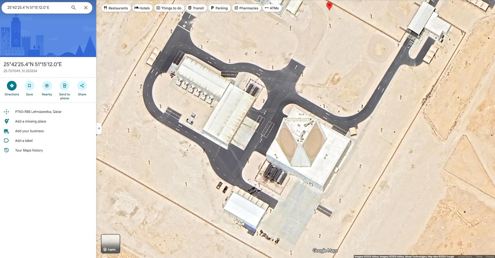
(Image source: Google Maps.)
A March 15, 2017 article on the Wright-Patterson Air Force Base website from 66th Air Base Group Public Affairs, announced a $1.06 billion contract to Raytheon Company to build the radar in Qatar (archived here). Included in the article is an artist's rendering of the facility (pictured below). This rendering from before construction is an almost perfect match with the site visible in 2026 satellite imagery.
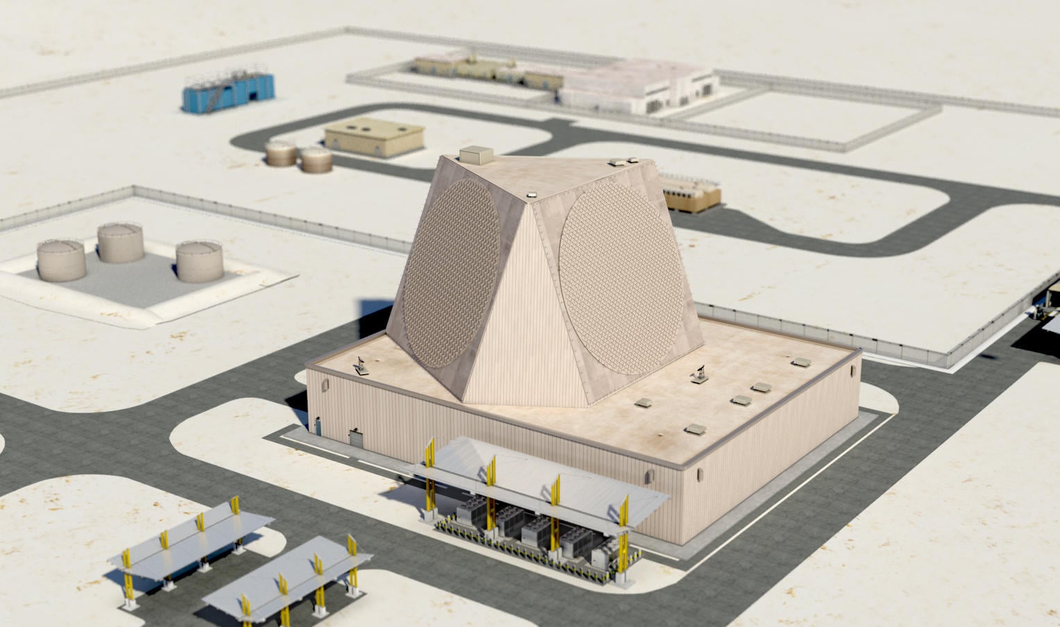
(Image source: screenshot from media.defense.gov)
The radar pictured in the X post has an octagonal antenna array, and only one array is visible, while the real facility has three circular antenna arrays. The real radar is part of a much larger rectangular building and there are several nearby buildings and paved roads.